

Fort Kaskaskia State Historic Site
Near Ellis Grove, Illinois, where the Kaskaskia River meets the Mississippi in a confluence of currents and history, a 200-acre bluff overlooks a landscape that tells a story of grandeur surrendered to nature’s patient theft. Fort Kaskaskia State Historic Site preserves earthen remains—ramparts in rough square formation with bastions at corners—of a small French fort built around 1759 to defend a town that had become, by then, the principal commercial center of the Illinois Country. Yet the river that once made Kaskaskia valuable through commerce eventually made it expendable through erosion: the original town of Old Kaskaskia, thriving on river-rich bottomland, occupied an island that the Mississippi gradually claimed until, by the 1880s-1890s, it was gone—washed away, leaving only memory and earthen traces on a bluff overlooking what had been taken.
The Town: From Jesuit Mission to Colonial Capital
Kaskaskia begins not as fort but as faith. Jesuit missionaries established a mission at the mouth of the Kaskaskia River in 1703, choosing location for access to the Illinois Confederation peoples whose lands, hunted and farmed for generations, offered spiritual opportunity. Shortly after, French settlers from Quebec and Louisiana began trickling toward the rich, alluvial farmland of the central Mississippi Valley—drawn by agricultural possibility, by commercial opportunity, by the frontier’s particular magnetism for those seeking to remake themselves.
They built a settlement in a half-circle of bottomland cradled by the Kaskaskia River and protected by a Mississippi River oxbow—land so fertile, so strategically positioned, that Kaskaskia quickly evolved from missionary outpost into thriving commercial center. For more than a century, the town remained the region’s undisputed economic and political hub, the place where wealth concentrated, where influence accumulated, where French colonial identity in the Illinois Country found its material expression.
The Fort: Small Ambition, Practical Defense
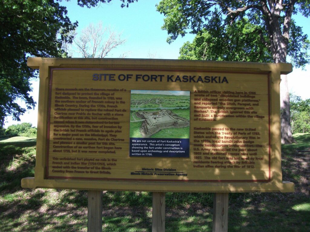
By the 1750s, as imperial rivalries between French and English threatened frontier stability, defensive infrastructure became necessity. Around 1759, the French constructed Fort Kaskaskia—a small installation containing merely a three-room barrack and a kitchen, apparently never fully completed despite intentions to make it substantial. Yet what the fort lacked in grandeur, it supplied in function: earthen ramparts arranged in rough square formation with bastions at corners provided defensive capability adequate to protect the commercial settlement it served.
The fort was periodically occupied by French or American troops depending on political winds and imperial allegiances—a structure of convenience rather than permanence, strategic value rather than architectural ambition. It stood in service to Kaskaskia proper, whose river commerce and agricultural wealth represented the genuine source of regional importance.
The River’s Slow Theft: When Geography Becomes Destiny
The Mississippi River, which initially made Kaskaskia prosperous through commerce and access, gradually became the agent of its undoing. Flooding, erosion, the river’s patient remaking of geography—these processes that had seemed manageable in the 18th century became catastrophic by the 19th. The island location that once protected and enriched Kaskaskia became a liability as water relentlessly worked to reclaim what human settlement had claimed from it.
By the 1880s-1890s, Old Kaskaskia was disappearing into the river itself—graves threatened, buildings destroyed, the physical town surrendering to hydraulic forces beyond any fortification’s capacity to resist. In response, in 1891, the State of Illinois established Garrison Hill Cemetery on the bluff, collecting the remains of early settlers whose graves were threatened by flooding, creating a new burial ground above the reach of water. In 1892, a monument was erected commemorating those early settlers—formal recognition that the town below had already ceased to exist.
From Colonial Capital to Historical Ruin
The irony deepens: Kaskaskia, which served as first capital of Illinois from 1818 to 1820, was already on its trajectory toward obliteration. The political capital moved elsewhere as the center of gravity shifted across the growing state. The commercial power that had made Kaskaskia dominant gradually dispersed as other settlements developed. What remained was memory—preserved in earthen remains on a bluff overlooking the river that had taken the town itself.
Lewis and Clark: A Brief Intersection
In September 1803, as the Corps of Discovery assembled for the Louisiana Purchase Expedition, they arrived at Kaskaskia with recruitment in mind. Kaskaskia, still substantial enough to house the Army Corps of Engineers, leased 150 acres to the expedition for three years. The Corps picked up eleven additional men here—soldiers, interpreters, laborers—strengthening their expedition as they prepared to venture into territory they were authorized to explore. The fort at that moment served its practical purpose: housing military installation, supporting imperial enterprise.
The fort plans from the Lewis and Clark era have not survived, but it probably resembled other American frontier forts of the period: wooden palisades with blockhouses at corners, pragmatic rather than impressive, functional accommodation for frontier military life. Yet Kaskaskia at this moment represented not frontier outpost but rather established settlement—the most important place in Illinois, the capital, the commercial center still expecting permanence.
The river would teach otherwise.
The Site Today: Bluff Overlooking Loss
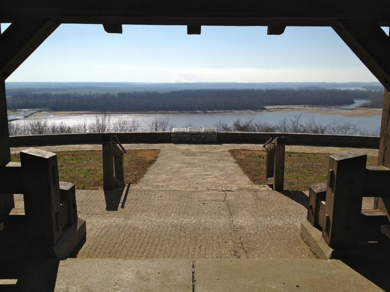
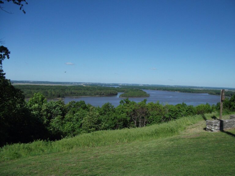
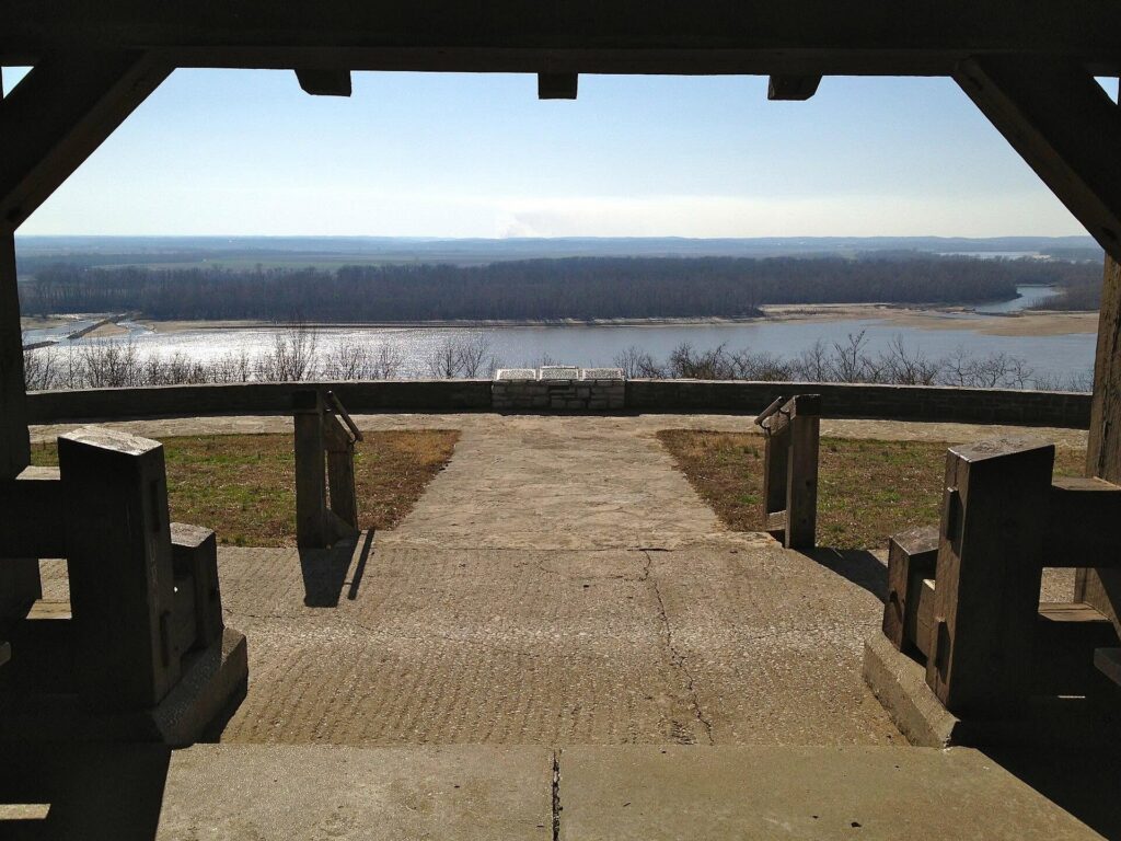
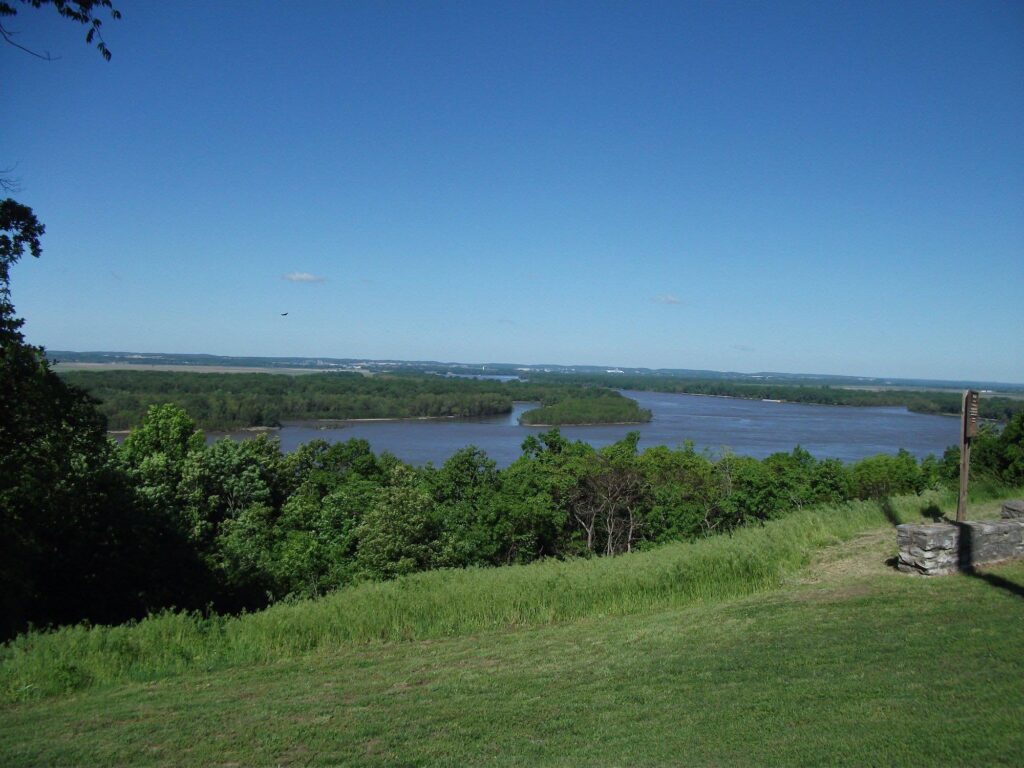
Fort Kaskaskia State Historic Site preserves four major sections: the earthen remains of the fort itself, Garrison Hill Cemetery with its 1892 monument to early settlers, the Mississippi River overlook and picnic area, and a campground accommodating those seeking overnight proximity to history. The grassy bluff offers sweeping views of the Mississippi River and Kaskaskia Island—offering present-day visitors the sight of what was taken, the perspective from which loss can be observed.
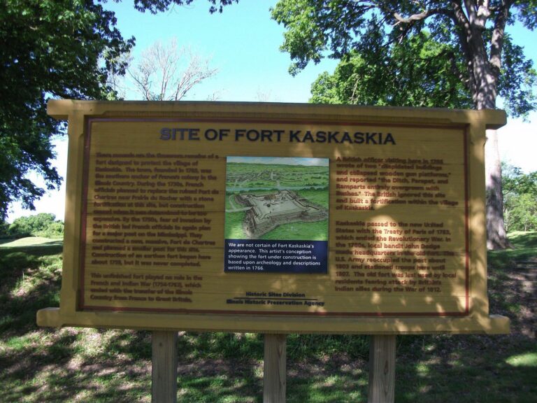
Interpretive panels describe the history of Kaskaskia village and its destruction—text preserving memory of what water erased, words substituting for the physical town no longer there. The site’s existence represents memorial to absence, preservation of what remains as testimony to what was lost.
Practical Information
- Name: Fort Kaskaskia State Historic Site
- Location: 4372 Park Road, Ellis Grove, Illinois 62277 (near Chester, Illinois)
- Phone: 618-859-3741
- Address Coordinates: 37.9681°N, -89.9095°W
- Size: 200 acres
- Hours: Grounds open year-round, 7:00 AM – 10:00 PM; Guided tours Monday-Friday, 8:00 AM – 3:30 PM (by calling site)
- Built: Original fort ca. 1759 (French); Lewis and Clark-era fort ca. 1803 (American)
- Fort Size: Small installation with three-room barrack and kitchen
- Key Features: Earthen ramparts with corner bastions, Garrison Hill Cemetery (established 1891), pioneer monument (erected 1892), Mississippi River overlook, campground
- Historic Significance: Defended Kaskaskia (founded 1703), first capital of Illinois 1818-1820
- Associated Site: Pierre Menard Home (accessible via footpath from bluff)
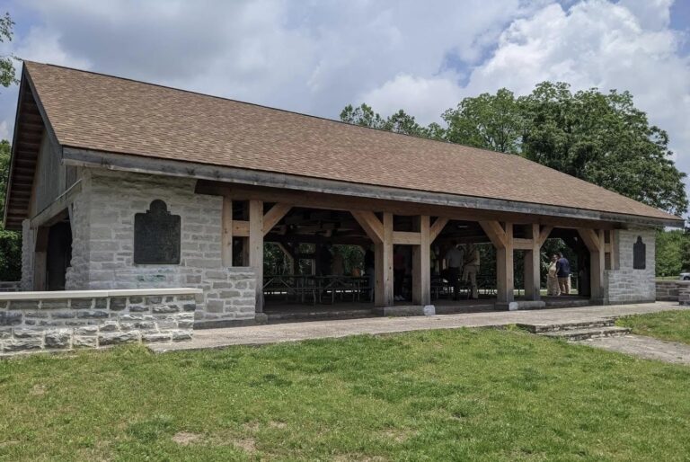
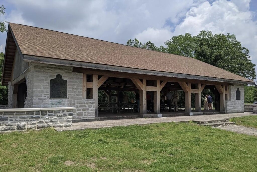
- Facilities: Campground with RV hookups, pavilions, picnic tables, grills, water, electricity
- Admission: No entrance fee; parking available on-site
- Designated: Contributing property to French Colonial Historic District
Perfect For:
- French colonial history enthusiasts
- Those exploring Lewis and Clark Expedition connections
- History researchers understanding commercial settlement dynamics
- Families seeking bluff-top picnicking with river views
- Campers interested in historic sites
- Anyone understanding loss, erosion, and nature’s reclamation
- Teachers bringing students to explore territorial history
- Those contemplating how geography determines destiny
Fort Kaskaskia State Historic Site succeeds not through grandeur but through honesty: it preserves earthen remains of a small fort serving a town that no longer exists, acknowledges what the river took, honors those whose graves were threatened by water. The memorial to early settlers stands as testament to loss rendered permanent through stone and inscription.
The site’s power derives partly from its melancholy: visitors stand on a bluff overlooking a river that erased the town it once enriched, gazing toward Kaskaskia Island, understanding through landscape itself why permanence is illusion and why settlement depends upon forces ultimately beyond human control.
Experience
You arrive at Fort Kaskaskia as morning light illuminates the bluff overlooking the Mississippi. You walk among earthen ramparts—the fort’s remains—trying to imagine the small garrison it housed, the commercial settlement it defended. The ramparts form a rough square, bastions marking corners, all of it worn by time and weather into gentle slopes rather than dramatic fortifications.
You move to Garrison Hill Cemetery, where the 1892 monument commemorates early settlers—people whose graves required relocation when the river threatened to claim them along with the town below. You read their names, understanding that this cemetery itself represents response to loss, that these graves exist here because another place could not hold them.
You walk to the overlook—that sweeping view of Mississippi and Kaskaskia Island. You understand through geography why Kaskaskia became important: the confluence, the river access, the bottomland fertility. You understand through erosion why it ceased to exist.
You return to picnic areas overlooking the river, perhaps staying to camp on this bluff above what Kaskaskia was. You contemplate how imperial ambition builds settlements, how commerce makes places flourish, how nature—patient and indifferent—reclaims what humans claim.
You leave understanding that Fort Kaskaskia is not primarily about the fort itself but about the town it defended, which no longer exists—a place where the river took what empire built, where commercial prosperity could not resist hydraulic reality, where loss became permanent enough to require memorials, where a bluff overlooks an island, and what matters most is what’s no longer there.
Visit Fort Kaskaskia State Historic Site seeking what modest fortifications and eroded remains can teach: how rivers shape settlement, how commerce concentrates in fragile locations, how political importance proves temporary, how nature reclaims what humans claim. Walk the earthen ramparts. Stand before the monument to early settlers. Overlook the river from the bluff. Camp if you stay. Understand that some places become historical sites not because they endured but because they were lost—and because memory, inscribed in stone and preserved in earth, insists they not be entirely forgotten.
Sorry, no records were found. Please adjust your search criteria and try again.
Sorry, unable to load the Maps API.